

Severe Weather Alert: Heavy Rain Expected in Tallahassee
Tallahassee severe weather rain forecast
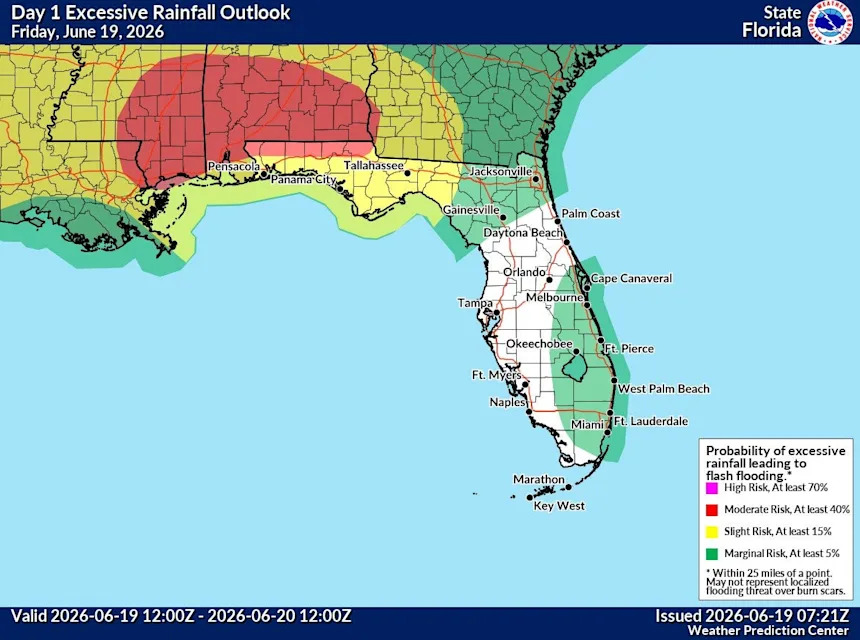
The National Weather Service in Tallahassee has issued a formal warning regarding significant weather activity across the Florida Panhandle for today, Friday, June 19, 2026. A Flood Watch is currently in effect through late tonight as additional rounds of heavy, persistent rain are expected to impact the area. Meteorological data indicates that moisture-rich conditions, exacerbated by the remnants of former Tropical Depression Arthur moving through Georgia, will drive continued thunderstorm development throughout the day.
These storms are expected to produce high rainfall rates, with additional accumulations of one to three inches commonly expected across the region. In areas where storms remain stationary or repetitive—a phenomenon known as training—rainfall totals could potentially exceed six inches, creating a high risk for life-threatening flash flooding.
Residents should remain vigilant for dangerous conditions, as the ground in many areas is already saturated from recent precipitation, making runoff highly reactive. Beyond the flood threat, the atmosphere remains unstable, with unseasonably fast winds aloft creating the potential for isolated damaging thunderstorm wind gusts.
While the most intense flood potential is concentrated near and west of the Panama City-to-Ashburn line, the entire region is under an active weather pattern. Local officials and the National Weather Service advise residents to monitor local radar closely and avoid driving through flooded roadways, as flash flooding remains the primary concern throughout the remainder of the day and into the night.